Click on objects in the map below to see pictures and descriptions of them. For a description of the external antennas, click on this sentence.
The BMEWS communications site at Saglek was part of the DEW (Distant Early Warning) Line tropospheric scatter communications network and was part of a chain of stations extending from Thule in Greenland down the East Coast of Canada into Newfoundland. Saglek was located between the Hopedale site to the South and the Resolution Island site to the North.
BMEWS communications sites replaced an earlier and less reliable tropospheric scatter system known as 'Polevault'. By the time I arrived at Saglek the Polevault antennas and equipment had been removed but they are visible in Fred Boutin's Moving Panorama of Saglek photographed in 1962 (they are the circular (parabolic) steel-frame dish antennas at the very end of the Panorama in the foreground)
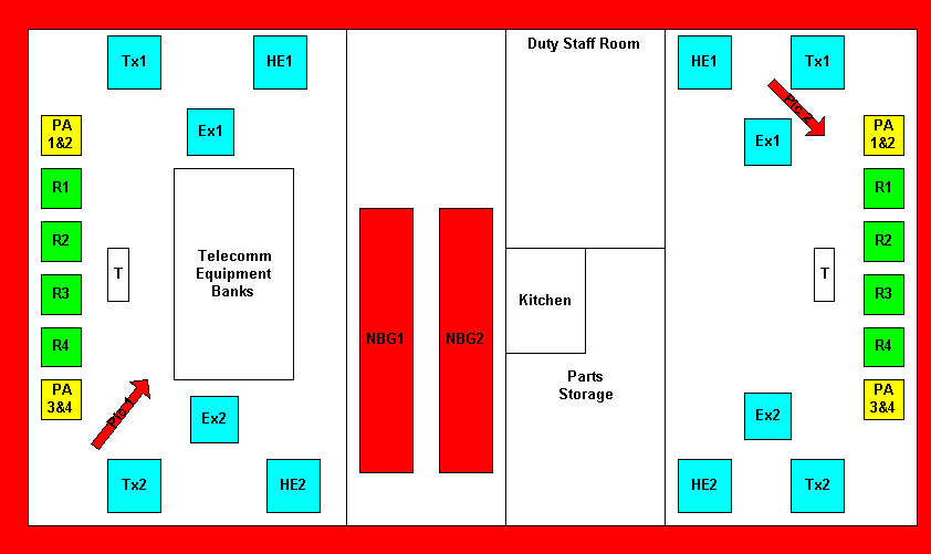
BMEWS stations were responsible for maintaining telephone and teletype communications. Using AN/FRC-39 or similar equipment they operated in the UHF band and were extremely reliable. It was a very rare occurrence to lose the communications link, even for a few seconds. During the 14 months I personally worked at Saglek, the communication link was continuously maintained without any failure due to equipment malfunction at the site. Reliability was ensured through full redundancy of equipment, regular and comprehensive preventive maintenance, and the personal commitment of maintenance personnel (determination that communications would not be lost on your shift).